


Can a simple map uncover hidden patterns in disease spread? The answer is yes.
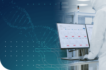
This innovative technology is called epidemiological mapping software. It empowers researchers, guides effective decision-making, and transforms raw data into vibrant, interactive visuals.
That’s how hidden trends emerge and spark dynamic strategies and breakthrough insights in public health.
What is epidemiological mapping software
Epidemiological mapping software is a powerful tool for understanding disease patterns.
Mapping is a key step in epidemiological investigations. It transforms raw numbers into clear visuals. Dot maps are a simple form of spatial data visualization. They plot cases on a map and highlight clusters. This approach generates new hypotheses about how infectious diseases spread and guide control measures.
For a better understanding, imagine a map – it could be a map of the world, of a country, or even of a town. On this map some dots show where people are getting sick; each dot represents a case. When many dots appear close together, it can reveal a cluster of infections and help scientists determine why that area is affected.
Mapping software serves as a valuable tool for advocacy and decision-making. It presents data in an easy-to-understand format that works in all settings. Dot maps can be updated over time to show the progression of an outbreak. They also include contextual details, such as potential transmission venues. New interactive mapping tools promise a user-friendly approach that respects privacy and offers real-time insights. [1]
Modern people have not invented epidemiological data science. Epidemiological mapping software has evolved from ancient methods of medical cartography. Early physicians, such as Hippocrates, observed how the environment affected health.
Pioneers like Dr. John Snow used hand-drawn maps to track disease outbreaks. Modern software builds on this rich legacy. However, epidemiological mapping software is also based on technological innovations and expertise in the field of geographic information systems (GIS). [2]
Understanding data management in epidemiology

Data management is the backbone of epidemiological mapping. High-quality data is collected from surveys, laboratories, and clinical records to form a complete picture of health trends. Each piece of information is meticulously recorded and integrated into a central database so that the maps accurately reflect disease distribution. Even a small error in data entry could lead to a misleading map. Every detail matters.
Integrating geolocation information with health data is a complex task. Geographic coordinates and addresses must be accurately entered and linked to clinical records. Double entry and systematic cleaning procedures help reduce errors. Strict quality control methods check the validity of every record.
How can we trust a map if the underlying epidemiologic data are flawed? The integrity of spatial data is essential for revealing true patterns in disease spread.
A robust infrastructure supports the entire process of epidemiological mapping. Secure databases, regular backups, and clear documentation are some of the ways to protect the sensitive information collected from multiple sources. Data protection protocols ensure that personal identifiers are separated from spatial data to preserve confidentiality.
Each step, from data entry to final analysis, follows standard operating procedures that reduce mistakes. A well-managed system not only saves time but also builds trust in the resulting maps.
Modern GIS software packages benefit greatly from meticulous data management practices. It combines clinical and geographic data to display disease clusters and time trends in a visual format.
Advanced systems can update maps in near real-time when new data is added. This integration guides public health decisions and helps target interventions where they are needed most. Can we afford to base decisions on maps built on unreliable data? When data management is strong, epidemiological mapping becomes a powerful tool for protecting public health. [3]
Key features of epidemiological mapping software
Epidemiological mapping software is a powerful tool with many useful features. They can vary from one software product to another but the different mapping applications have many similarities.
Here are the most important:
- Real-time disease tracking – Epidemiological mapping software provides real-time surveillance of disease outbreaks as they happen. It creates live maps that show new cases, emerging hotspots, and the spread of infections over time. This feature is crucial for the rapid response of public health authorities. Real-time tracking played a key role in managing outbreaks like COVID-19, where timely updates on case numbers helped authorities implement targeted restrictions and allocate medical supplies efficiently.
- Advanced spatial analysis – epidemiological mapping software does not simply plot disease cases on a map. Instead, it helps identify clusters of disease and analyze correlations between health outcomes and environmental factors such as pollution levels or population groups’ density. Moreover, tools like heatmaps, spatial statistics, and risk factor analysis provide more benefits for deep insights.
- Integration of multiple data sources – We all know that knowledge is power. One of the greatest strengths of epidemiological mapping software is its ability to merge various types of data into a single system. It does not rely solely on medical records but also integrates environmental conditions, demographic statistics, death rates, and even social behaviors. For instance, an increase in asthma cases may be linked to rising air pollution levels, while a surge in flu infections could correlate with changing weather patterns.
- Predictive modeling and risk assessment – What if we could predict the next disease outbreak before it happens? That is exactly the point of epidemiological mapping. The software uses predictive modeling to assess possible risk factors and forecast potential outbreaks. It generates models that help experts estimate where and when new cases might appear. For example, if data suggests that an area with poor sanitation and high population density is at risk of a cholera outbreak, interventions such as clean water initiatives and public health campaigns can be implemented in advance.
- Customizable and interactive maps – Epidemiological mapping software is not a one-size-fits-all solution. It allows users to customize maps to suit specific needs. Public health officials can zoom in on particular regions and filter data by time frames. Also, they can adjust map layers to highlight certain variables, e.g. age groups, vaccination rates, or healthcare access. These interactive features make it easier to explore patterns and communicate clinical findings to policymakers and researchers.
- Automated alerts and notifications – When an outbreak begins, time is everything. Automated alerts and notifications in epidemiological mapping software ensure that public health professionals receive timely warnings about new cases, rising infection rates, and other factors. These alerts can be programmed to trigger based on predefined thresholds. In the event of the spread of unknown infectious agents, automated notifications can help contain the situation before it gets out of control.
- Secure data handling – Health data is sensitive, and ensuring its security is a top priority. Epidemiological mapping software includes strong encryption, user authentication, and compliance with data protection regulations. Since disease mapping often involves location-based data, it is essential to separate personal identifiers from public health records to maintain confidentiality. Many mapping platforms also allow role-based access and other cybersecurity features.
Epidemiological mapping software with the mentioned features is a game-changer for public health. This software empowers health professionals to respond quickly and efficiently to emerging threats. [4]
Data collection and integration
Data collection in epidemiological mapping software has been transformed by recent technical and logistical innovations. Hand-held devices now allow field users to add precise geographic coordinates to their data collection from anywhere in the world. Global positioning systems and direct-to-GIS data links enable real-time tracking of such data.
The devices are affordable and easy to use. Each point is recorded to the nearest meter on the ground. These innovations have made data collection faster and more accurate. Data collected in the field can be analyzed on the same day and acted upon immediately.
Integration of diverse data sources is a cornerstone of modern epidemiological mapping. Overhead imaging technology has undergone a revolution with improvements in infrared, thermal, and radar sensors. Satellite images and aerial photographs are now available at high spatial resolutions. Formerly secret data are now broadly available through public programs and online archives.
Moreover, standard file formats such as GIF and TIF facilitate smooth data transfer and sharing. Efforts to standardize metadata ensure that datasets are well cataloged and easily searchable. Public domain datasets, such as the Digital Chart of the World, combine with GPS and field data to form a comprehensive framework.
These advancements reduce the time required for data collection and integration, allowing researchers to focus on analysis and decision-making. [5]
Spatial analysis and visualization tools
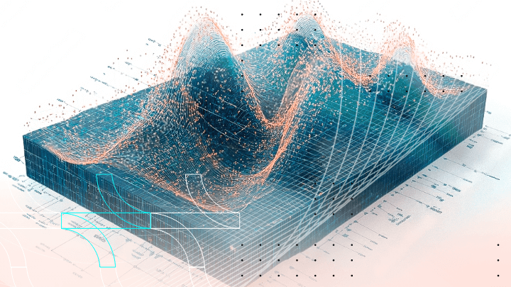
Spatial analysis in epidemiological mapping software unlocks the potential of health data in powerful ways. The technology transforms raw numbers into clear visual insights. It brings together methods from different sciences such as geography and statistics. Spatial data carries a geographic signature that ties information to a specific location, while non spatial data lacks this contextual detail.
Health professionals are now able to view disease distributions with unprecedented clarity. Maps reveal clusters and trends that were once hidden in tables.
Visualization tools make the analysis even more engaging. They layer multiple datasets into one coherent picture. Thematic maps display disease clusters and trends with clarity. Visualization turns static figures into interactive narratives that expose the evolution of an outbreak.
Advanced visualization extends beyond static maps. These maps are not just pretty pictures – they are dynamic, allowing users to zoom, filter, and explore details. How can we ignore the impact of such vivid displays in guiding public health interventions?
For example, an animation can show the progression or retreat of disease over space and time. Health officials can see how epidemics expand and contract, which informs timely interventions. Regression analysis and spatial diffusion models add statistical depth to the visual data. The system integrates these models to generate a composite risk index that is easily mapped.
This integration of statistical analysis with visual display deepens our understanding of disease spread. The result is a tool that not only highlights current health issues but also predicts future trends, allowing for proactive decisions in public health. This integration empowers researchers to test hypotheses and enables effective disease control programs and prevention measures. [5]
Utilizing geospatial data for disease surveillance
Geospatial data is a vital resource in modern disease surveillance. It carries information about specific locations and transforms raw numbers into interactive maps. New technologies such as global positioning systems and satellite imagery have made it possible to capture precise location data in real-time. Hand-held devices now record GPS coordinates as field workers collect samples or report cases.
For example, HealthMap aggregates outbreak reports from diverse sources and displays them on dynamic maps. Wastewater surveillance also uses geospatial data to track virus levels in different communities. This rich spatial context enables health officials to visualize disease patterns clearly and respond swiftly to emerging threats. [6]
Utilizing geospatial data transforms disease surveillance into a proactive endeavor. Public health experts combine data from clinical reports, environmental sensors, and digital media to create a comprehensive view of outbreaks. For instance, researchers in the United States used geospatial techniques to monitor a surge in respiratory syncytial virus by mapping virus concentrations in wastewater. This provided early warning weeks before hospitals reported increases. [7]
In another example, models that incorporate mosquito population data and environmental factors have improved forecasts for West Nile virus outbreaks. These maps guide targeted interventions, such as localized vaccination campaigns and vector control measures, by highlighting high-risk areas.
The continuous updating of these maps offers a near real-time overview of disease dynamics. As a result, public health agencies are better able to allocate resources and implement timely measures to protect communities effectively. [8]
Advanced statistical analysis and modeling

Advanced and basic statistical analysis have become a cornerstone in epidemiology mapping. By employing sophisticated models, researchers can decipher complex patterns in disease distribution.
Fundamental statistics
For instance, Generalized Linear Models (GLMs) allow for the examination of relationships between various risk factors and disease occurrence. These models can handle different types of data distributions.
Similarly, Generalized Additive Models (GAMs) offer flexibility by fitting non-linear relationships. They provide deeper insights into how variables like age, socioeconomic status, or environmental exposures influence disease rates. By these variables, public health professionals can identify high-risk populations and tailor interventions more effectively.
Spatial statistics further enhance the precision of epidemiological mapping. Techniques such as Geographically Weighted Regression (GWR) enable analysts to explore how relationships between variables change across different locations. This localized approach is crucial because factors contributing to disease prevalence can vary significantly from one area to another.
For example, the impact of air pollution on respiratory chronic diseases might be more pronounced in urban centers compared to rural areas. By applying GWR, researchers can pinpoint these variations, leading to targeted public health strategies.
Additionally, Bayesian hierarchical models are employed to account for spatial dependence and provide more accurate estimates by borrowing strength from neighboring regions. This method is particularly useful in disease mapping, where analyzing data from adjacent areas can improve the reliability of estimates in regions with sparse data.
Advances in statistical modelling
The advent of machine learning has introduced new dimensions to epidemiological modeling. Different algorithms can manage large datasets with numerous variables and capture intricate patterns that traditional models might miss.
Such algorithms are random forests and neural networks. For instance, in predicting the spread of vector-borne diseases like malaria, these algorithms can incorporate climate data, mosquito population dynamics, and human movement patterns to forecast outbreaks with remarkable accuracy.
Moreover, graph neural networks have been utilized to forecast West Nile virus outbreaks by modeling spatial dependencies in the data. With the help of these advanced statistical methods, epidemiologists can stay ahead of disease trends and implement preventive measures before outbreaks escalate. This proactive approach not only saves lives but also optimizes resource allocation in public health initiatives. [9]
Real-time monitoring and reporting capabilities
Public health surveillance or monitoring is the continuous, systematic collection of health-related data. It enables the timely dissemination of information to those responsible for preventing and controlling disease and injury.
There are some basic concepts in the field of public health surveillance:
- Indicator-based surveillance: This method tracks measurable factors like new cases of a disease, vaccination rates, or behaviors such as smoking frequency. It helps decision-makers assess public health trends and intervention outcomes;
- Active surveillance: Involves health officials directly contacting hospitals or communities to gather data. It provides the most accurate and up-to-date information but requires significant resources;
- Passive surveillance: This method relies on healthcare facilities and professionals to report disease cases voluntarily. It is cost-effective and covers large areas but can suffer from delays and incomplete data;
- Routine health information systems: A passive approach where hospitals and clinics regularly submit disease reports. It helps monitor long-term health trends and assess health services’ effectiveness;
- Health information and management systems: Focuses on reporting financial, logistical, and administrative data in public health. It ensures smooth operations and resource allocation;
- Categorical surveillance: Targets specific diseases or risk factors, such as HIV or tuberculosis. While useful for tracking individual diseases, it can overwhelm health care providers with redundant reporting;
- Integrated surveillance: Combines active and passive methods under a single system. It collects data on multiple diseases simultaneously, improving efficiency and coordination across programs;
- Syndromic surveillance: This methodology tracks symptoms rather than confirmed diagnoses. It is useful for early outbreak detection, especially in areas with limited lab resources. However, it may lead to false alarms due to non-specific symptoms;
- Behavioral Risk Factor Surveillance System (BRFSS): Uses repeated surveys to monitor behaviors linked to disease risk, such as smoking, alcohol consumption, and physical activity. It helps evaluate the impact of public health campaigns before actual health effects become evident.
Effective monitoring and reporting systems in public health offer numerous advantages. They enable the early detection of disease outbreaks and allow for swift responses to emerging health threats. For example, during the COVID-19 pandemic, real-time data collection and analysis facilitated timely interventions.
Additionally, continuous monitoring provides valuable insights into the effectiveness of public health initiatives. Keeping a vigilant eye on health trends helps authorities implement targeted measures to protect communities.
Moreover, robust reporting systems foster transparency and trust within the community. When health data is shared openly, it empowers individuals to make informed decisions about their well-being. For instance, public access to vaccination rates and infection statistics can encourage proactive health behaviors.
Furthermore, comprehensive surveillance aids in identifying health disparities among defined populations and guiding policies to address inequities. By leveraging advanced monitoring tools, public health officials can stay ahead of potential crises, ensuring a healthier future for all. [10]

Discover how we can help outsource Healthcare projects efficiently
Speak to an expert today, and see how our on-demand IT talent and augmented teams can efficiently deliver value at every step of your roadmap.
Interoperability with health information systems
Interoperability between epidemiology mapping software and health information systems is vital for effective disease surveillance and response as it is crucial in every other healthcare field.
A notable example of this is the District Health Information Software 2 (DHIS2) – a free, open-source platform widely used for health data analysis. It integrates data from various health programs and supports interoperability through standardized data formats. In this way, it facilitates comprehensive epidemiological mapping. [11]
Another valuable software is Epi Info. This is a product developed by the Centers for Disease Control and Prevention (CDC). It supports interoperability by allowing data import and export in various formats, facilitating integration with other health information systems for comprehensive epidemiological mapping. [12]
These examples demonstrate how interoperability between GIS software and health information systems enhances the ability to monitor, analyze, and respond to health events effectively.
Conclusion
In conclusion, modern-day public health cannot succeed in prevention. Advanced statistical analysis in collaboration with spatial analysis and visualization tools allows real-time monitoring to give timely solutions.
In other words, when epidemiological analysis meets statistical precision, raw health data becomes a compass that guides proactive interventions.
Sources
[1]https://bmcinfectdis.biomedcentral.com/articles/10.1186/s12879-016-1475-5
[2]https://pubmed.ncbi.nlm.nih.gov/25114567/
[3]https://link.springer.com/referenceworkentry/10.1007/978-0-387-09834-0_48
[4]https://wjarr.com/sites/default/files/WJARR-2023-2684.pdf
[5]https://wwwnc.cdc.gov/eid/article/2/2/96-0202_article
[6]https://pubmed.ncbi.nlm.nih.gov/18613747/
[7]https://www.wired.com/story/wastewater-offers-an-early-alarm-system-for-a-deadly-virus/
[8]https://agupubs.onlinelibrary.wiley.com/doi/full/10.1029/2023GH000784
[9]https://pmc.ncbi.nlm.nih.gov/articles/PMC8036932/
[10]https://www.ncbi.nlm.nih.gov/books/NBK11770/
[11]https://en.wikipedia.org/wiki/DHIS2
[12]https://en.wikipedia.org/wiki/Epi_Info
Yoanna is a Technical Copywriter with a keen interest in healthcare innovations and medicine. She is dedicated to crafting clear and engaging content that highlights the latest advancements and trends in the medical field.
linkedin